Application Description
City routes, live traffic, transit routes, parking, offline map and navigation.
We are excited to announce that we have updated 2GIS. The current version of the app has become challenging to display all the comprehensive details about cities and companies. In the new 2GIS, we've revamped the design, introduced a new search system, enhanced city updates, and integrated favorites with 2gis.ru.
Services, addresses, and companies
2GIS provides detailed information about which service provider operates in your residence, the locations of district hospitals, and post offices. It assists in selecting cafes or service centers based on reviews and photos, displaying their opening hours and contact numbers.
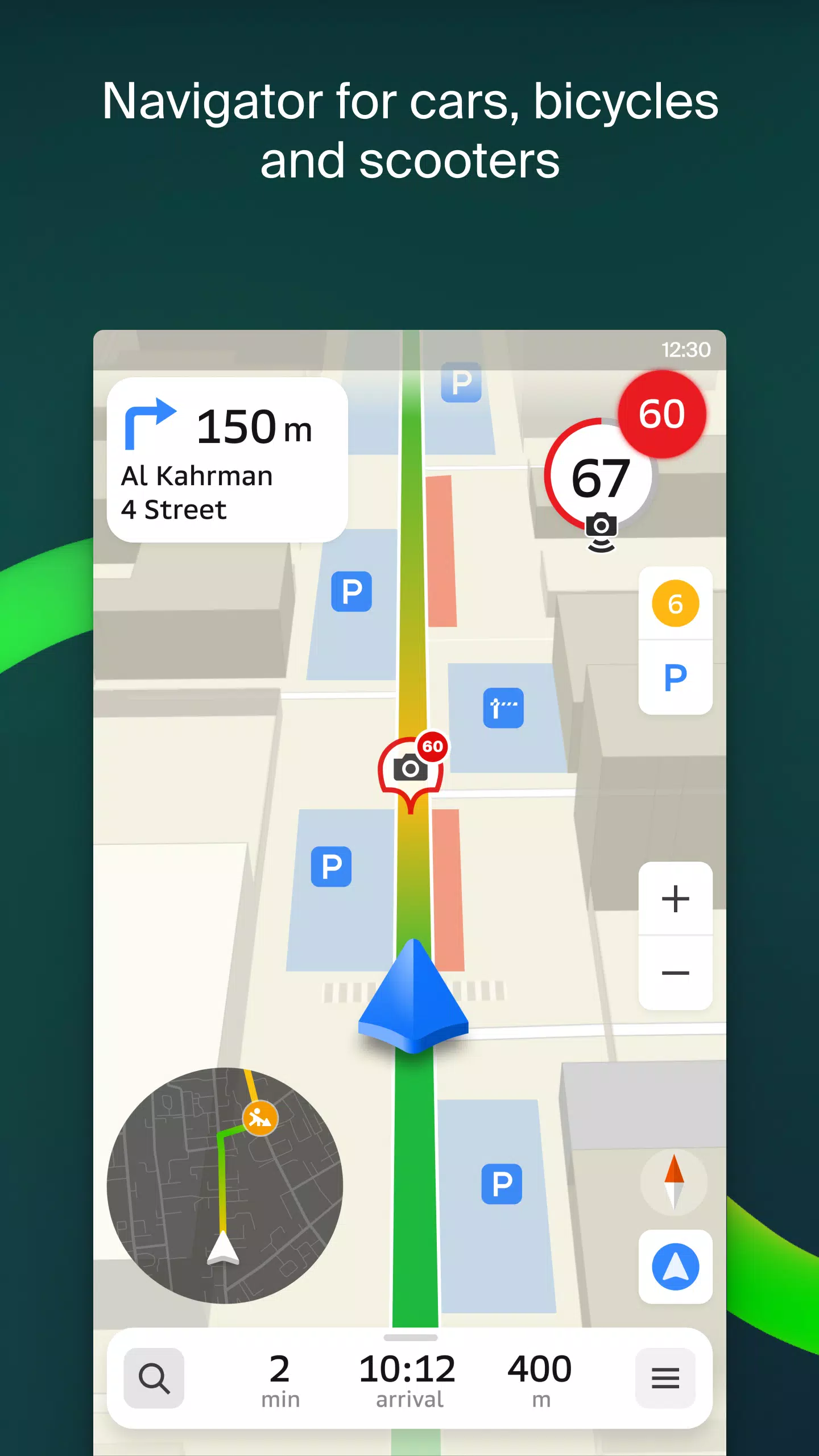
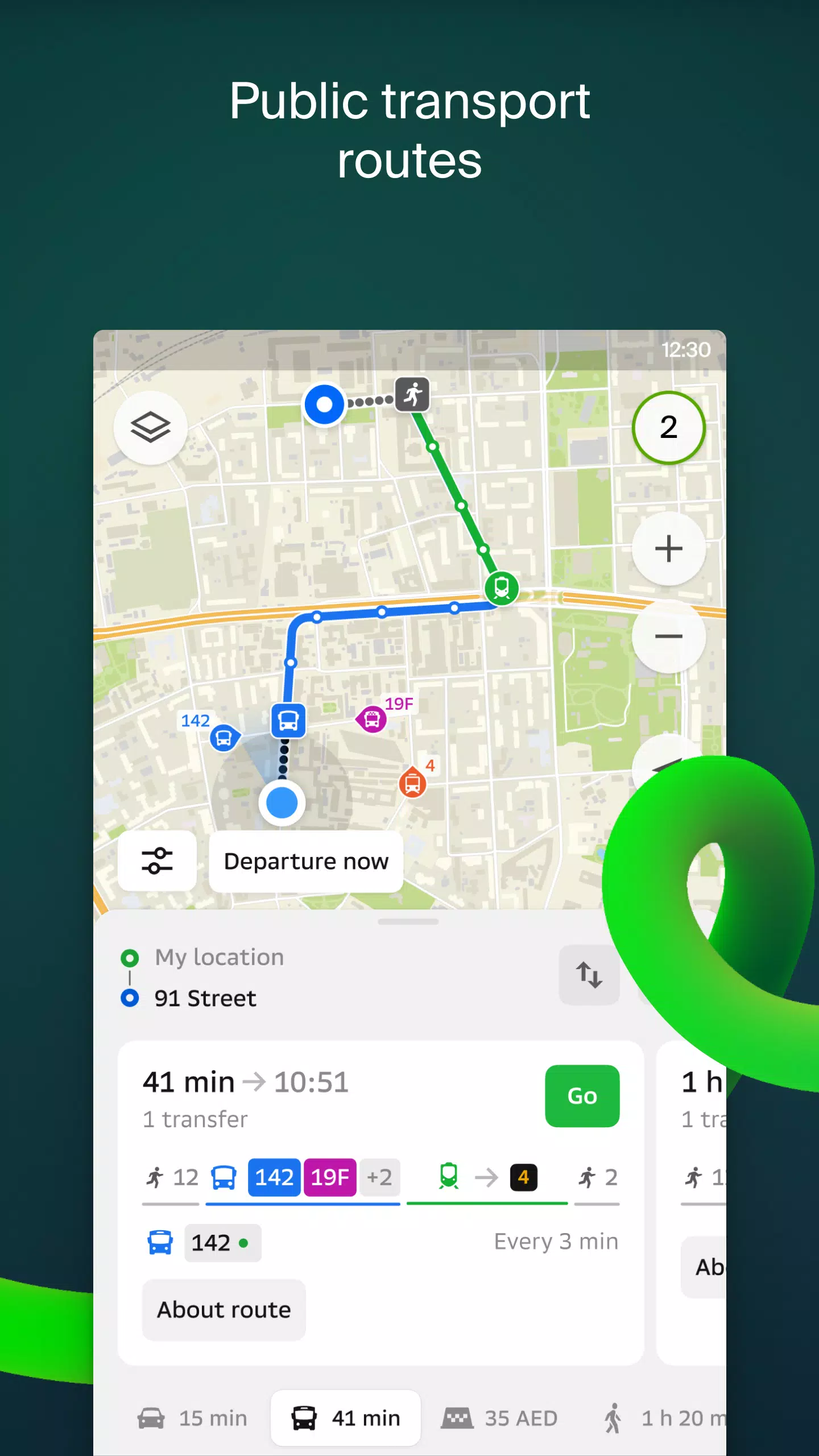
Transport and navigation
For drivers, 2GIS offers real-time navigation with voice-guided instructions, taking into account traffic conditions and road closures. It dynamically recalculates routes if you deviate from the planned path. For pedestrians, it provides options for traveling by bus, metro, train, cable car, and river tram.
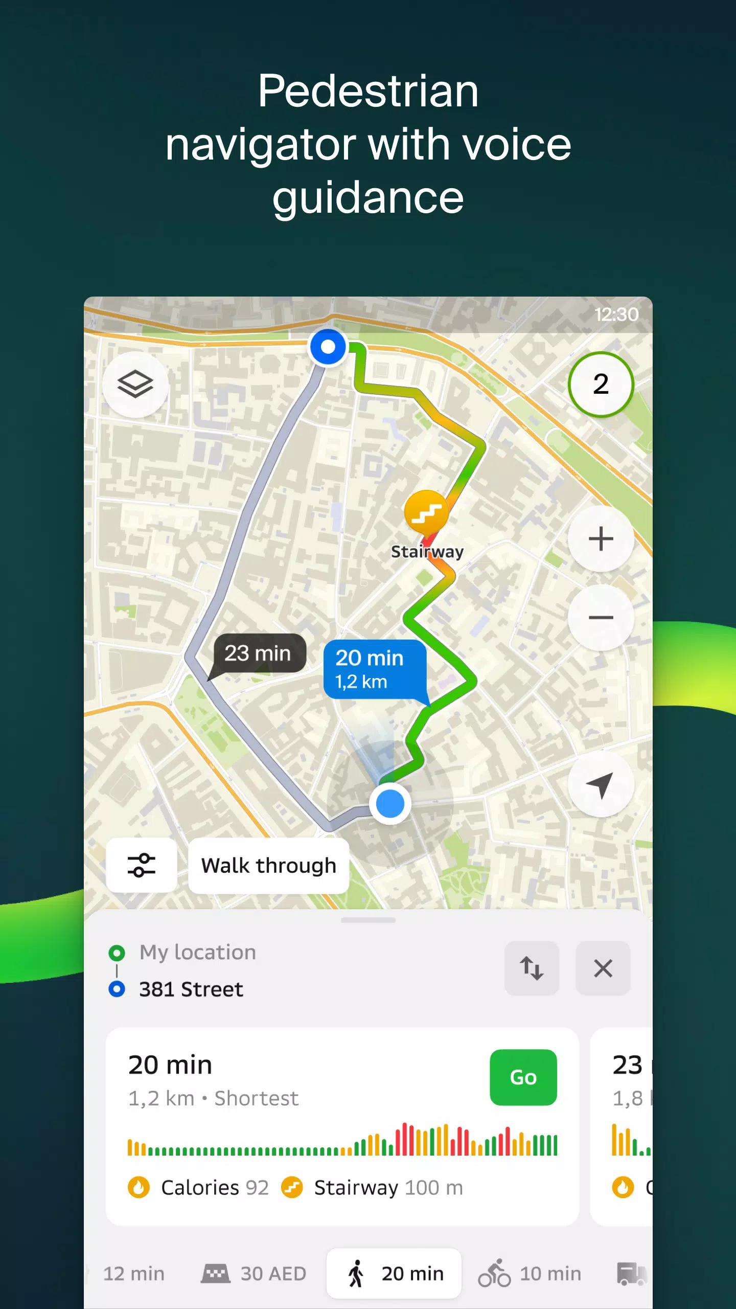
Walking routes
Pedestrian navigation in 2GIS guides you on foot, functioning in the background with voice guidance.
Friends on the map
With 2GIS, you can now track the real-time location of your friends and children on the map. You have full control over who can see your location and manage your visibility settings.
Building entrances
Avoid the hassle of finding entrances to business centers with 2GIS. The app knows the entry points for 2.5 million companies and will guide you directly to the door, whether you're traveling by public transport or car.
Plans of shopping centres
Navigate effortlessly inside shopping centers with 2GIS. The app shows the locations of shops, cafes, ATMs, and restrooms, helping you plan your visit in advance.
A 2GIS beta Notifications companion app for smart watches on Wear OS
The 2GIS beta companion app for Wear OS smart watches is a useful tool for navigating routes on foot, by bike, or by public transport directly from the main 2GIS beta app. View the map, receive maneuver hints, and get vibration alerts when approaching a turn or your destination. The companion app launches automatically when you start navigation on your phone and is compatible with Wear OS 3.0 or later.
By using the beta version, you'll receive the latest updates as we fix bugs and errors, contributing to the development of the new 2GIS, which will be used by millions. You can run both the original and beta versions simultaneously and switch between them at any time.
For support, please contact [email protected].
What's New in the Latest Version 6.44.1.559.3
Last updated on Oct 19, 2024
We're thrilled to bring you beautiful, crisp updates in our latest version:
- We now display wide, realistic roads on the main map and during route searches.
- Introducing Chats for Friends! Now you can message each other without leaving the map.
- Added notifications when a friend is nearby, which you can turn off in settings.
- Just in time for ski season, we've added ski lift statuses on slopes to see if they're open.
- For public transport routes that include walking, we'll calculate the walking part in steps.
Maps & Navigation


 Apps like 2GIS beta