Application Description
With 2GIS, navigating your world has never been easier. Whether you're driving, walking, or taking public transit, this comprehensive map service offers everything you need to stay on track—literally and figuratively. Equipped with accurate GPS navigation, 2GIS helps you find your way through detailed maps featuring districts, streets, bus stops, gas stations, and countless other points of interest. You'll always know where you stand, whether you're exploring familiar terrain or venturing into uncharted territory.
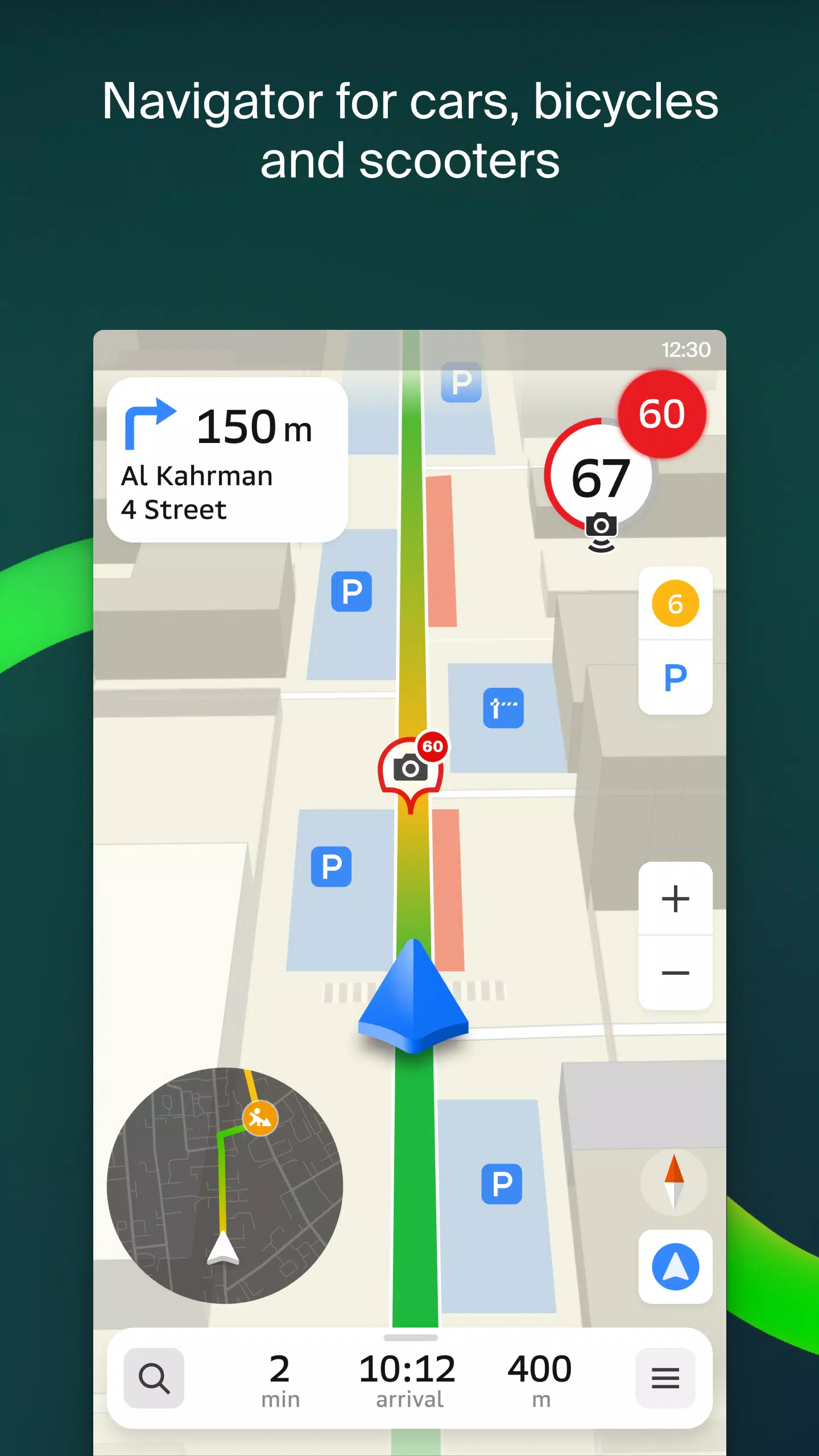
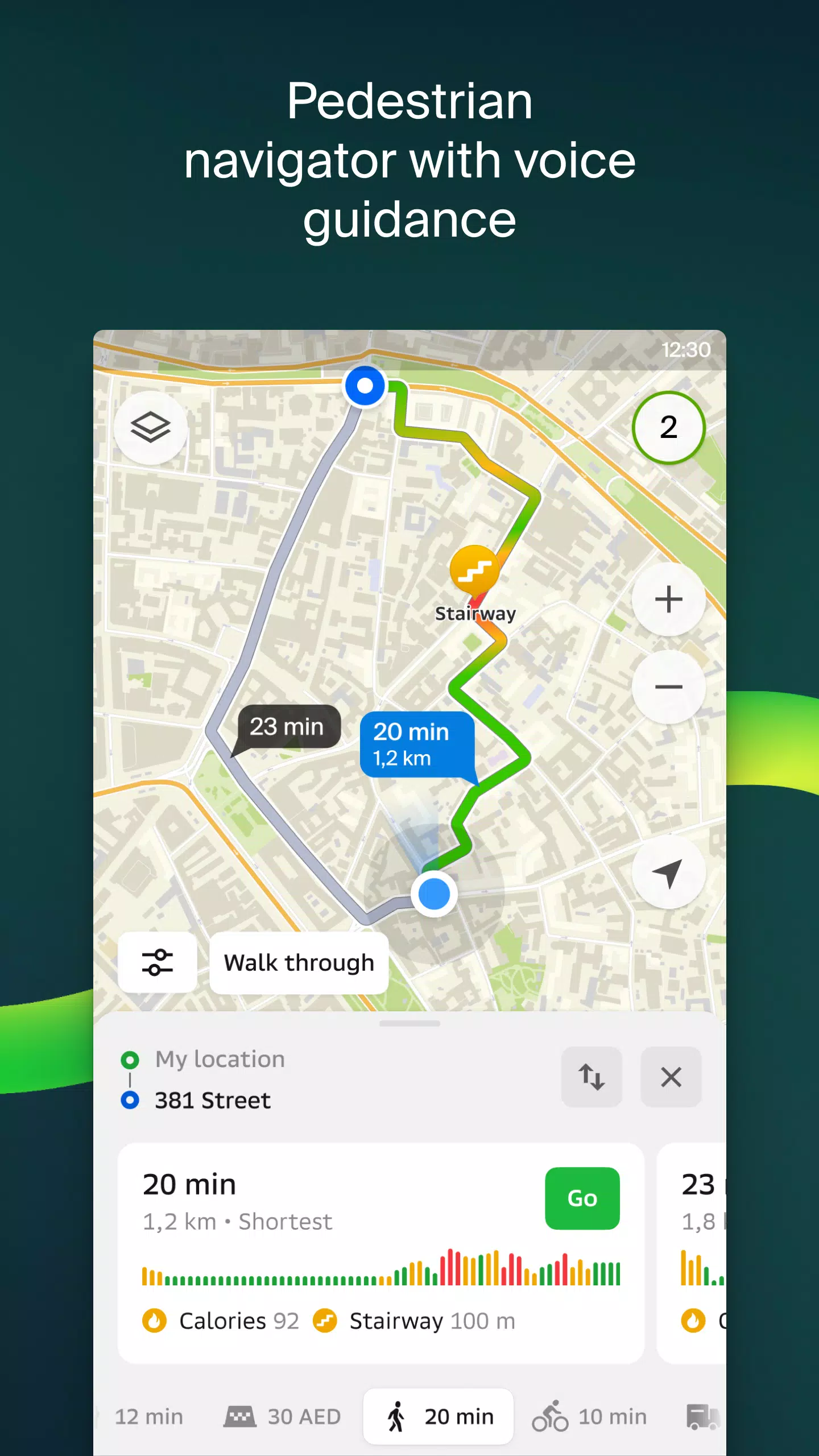
For drivers, 2GIS provides real-time traffic updates, route planning that considers speed limits, toll roads, and construction zones, and even supports navigation across multiple cities. The app also features a dedicated Android Auto companion app, ensuring seamless integration with your vehicle. Meanwhile, cyclists and pedestrians can enjoy pedestrian-friendly routes complete with voice guidance and background support.
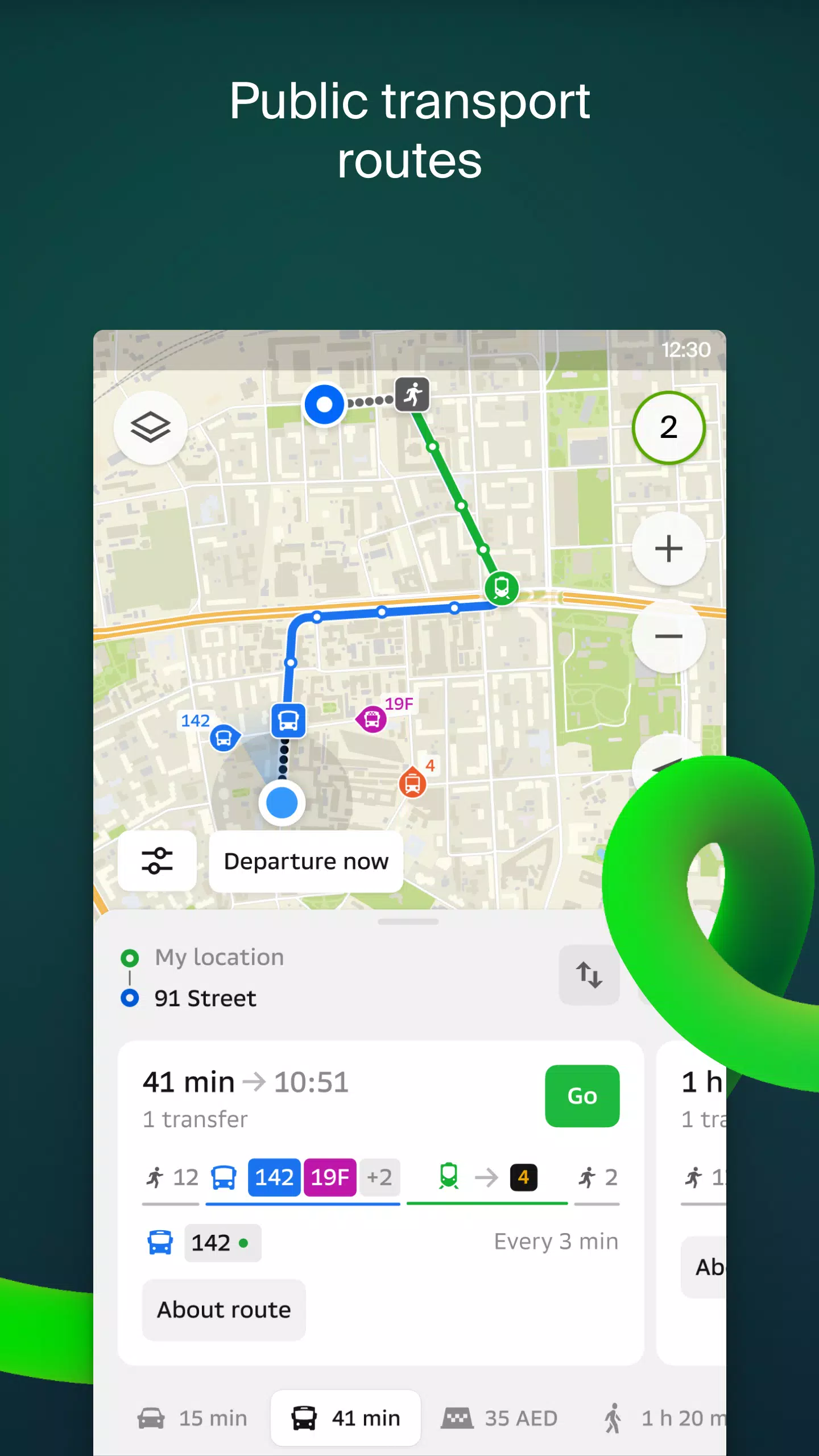
But 2GIS doesn’t stop there. Its robust public transit tools keep you updated on schedules and live routes, while its truck-specific navigation caters to commercial vehicles with tailored paths that account for size and weight restrictions. Additionally, users can enjoy social features like live friend tracking and customizable location sharing options to enhance personal safety.
The app’s rich directory ensures you have all the details you need, from contact information and working hours to photos and reviews. Plus, it serves as a travel guide, pointing out must-see attractions, free Wi-Fi spots, and more. For added convenience, there’s a dedicated companion app for Wear OS smartwatches, allowing you to manage routes hands-free.
With extensive coverage spanning major cities across the UAE, Russia, Belarus, Kazakhstan, Uzbekistan, Azerbaijan, and Kyrgyzstan, 2GIS keeps you connected no matter where life takes you. Have questions? Reach out to the support team at [email protected].
Maps & Navigation


 Apps like 2GIS: Offline map & navigation