Application Description
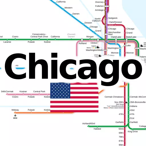
Discover all essential subway and railroad maps of Chicago conveniently compiled into one easy-to-use application. This app provides offline access to the following line networks without the need for additional downloads:
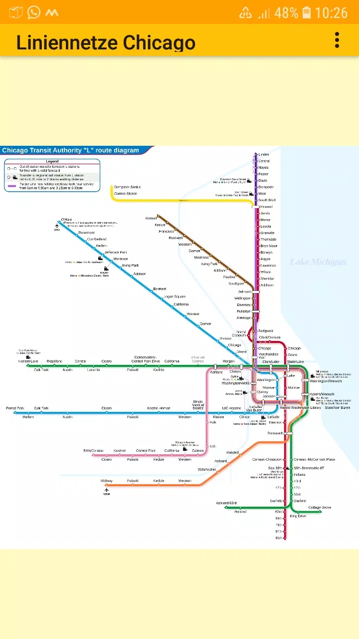
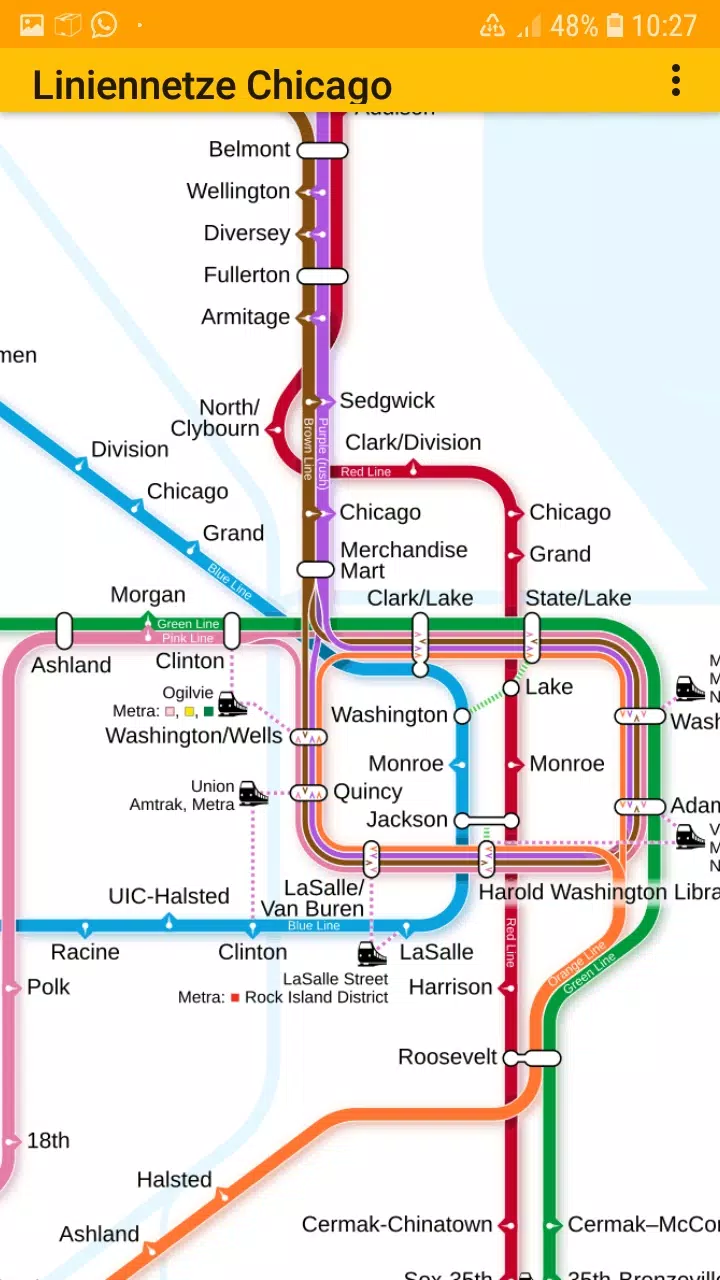
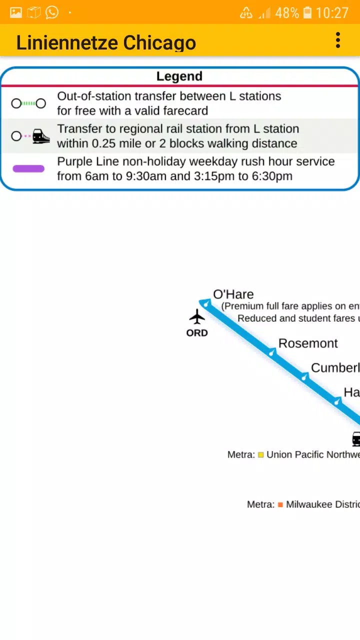
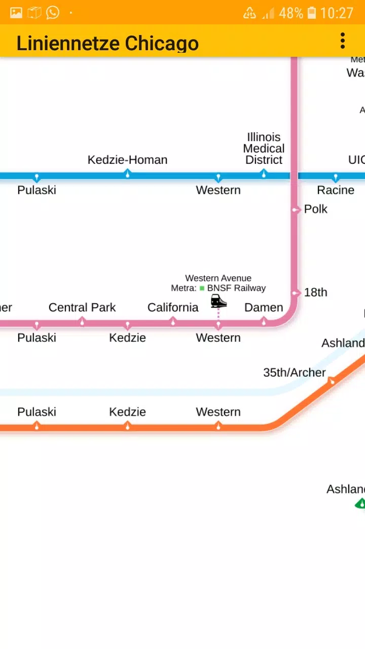
• Chicago elevated „L“ rapid transit system
Stay connected with us on Facebook: https://www.facebook.com/203994253076876
Visit our homepage for more information: https://dieeinsteiger.blogspot.com
Designed for both Chicago residents and tourists, this app offers a user-friendly, zoomable interface for exploring the city's transit networks. It includes simple maps that allow you to scroll, zoom in, and zoom out effortlessly. The app features multiple tabs, each displaying different types of transit maps.
The metro line network, also referred to as the underground, rail transit map, urban tube map, or public subway, is readily accessible within the app.
We welcome your suggestions for improvements, ideas, wishes, or feedback. You can reach out via email or use the contact form on our website: https://dieeinsteiger.blogspot.com/p/kontakt.html
Notices:
• Compatible with phones and tablets running Android 4.4 (KitKat, API 19) to Android 13.0 (API 33).
• Please note that the accuracy and completeness of the app's content are not guaranteed.
• The maps embedded in this app are licensed under Creative Commons (CC BY-SA 4.0) and were created by Chinese Wikipedia user Sameboat (copyright holder).
Enjoy exploring the transit networks of Chicago with our app, available on the Google Play Store, brought to you by dieEinsteiger.
What's New in the Latest Version 1.3
Last updated on Oct 20, 2024
v1.3 (06-08-2024)
- Updated to Android API 35
Maps & Navigation

 Apps like LineNetwork Chicago